Image: Demorest-Auction-Land-Plat-1890-restore

Size of this preview: 369 × 599 pixels. Other resolutions: 148 × 240 pixels | 1,842 × 2,992 pixels.
Original image (1,842 × 2,992 pixels, file size: 2.83 MB, MIME type: image/jpeg)
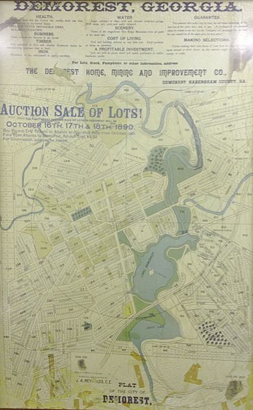
Description: Map of land plat and property lines for an auction of land in Demorest, Georgia in Habersham County. The auction was put on by the Demorest Home, Mining and Improvement Company, which was at one point the largest land owner in Demorest. The map shows the location of the former Lake Demorest, the Blue Ridge and Atlantic Rail Road, and Hazel Creek.
Title: Demorest-Auction-Land-Plat-1890-restore
Credit: Poster at Piedmont College, in Demorest, Habersham County, Georgia
Author: The Demorest Home, Mining and Improvement Company
Usage Terms: Public domain
License: Public domain
Attribution Required?: No
Image usage
The following page links to this image:

All content from Kiddle encyclopedia articles (including the article images and facts) can be freely used under Attribution-ShareAlike license, unless stated otherwise.
