Image: Delaware Basin map

Size of this preview: 800 × 506 pixels. Other resolutions: 320 × 202 pixels | 1,160 × 734 pixels.
Original image (1,160 × 734 pixels, file size: 123 KB, MIME type: image/png)
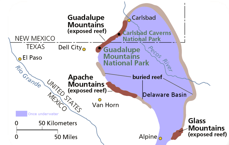
Description: Map of the Delaware Basin — a geologic depositional and structural basin in West Texas and southeastern New Mexico. It is part of the larger Permian Basin, itself contained within the Mid-Continent oil province. Guadalupe Mountains National Park and Carlsbad Caverns National Park protect part of the basin.
Title: Delaware Basin map
Credit: Own work
Author: National Park Service
Permission: From pdf linked from http://www.nps.gov/gumo/naturescience/geologicformations.htm Edited using the GIMP. I place those edits in the public domain.
Usage Terms: Public domain
License: Public domain
Attribution Required?: No
Image usage
The following page links to this image:

All content from Kiddle encyclopedia articles (including the article images and facts) can be freely used under Attribution-ShareAlike license, unless stated otherwise.
