Image: Defending Chain Bridge, 1861 (493989022) (2)
Defending_Chain_Bridge,_1861_(493989022)_(2).jpg (640 × 473 pixels, file size: 79 KB, MIME type: image/jpeg)
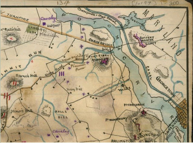
Description: Civil War map of forts near Chain Bridge, Washington, D.C. Robert K. Sneden, Map showing positions of Union and Rebel forces Septr [sic] 1861.
Title: Defending Chain Bridge, 1861 (493989022) (2)
Credit: "Defending Chain Bridge, 1861" Flickr uploader: rockcreek from Washington, D.C. Uploaded to Commons by: AlbertHerring Upload date: 2007-05-11 16:26
Author: Robert Knox Sneden
Permission: This image is a work of a U.S. military or Department of Defense employee, taken or made as part of that person's official duties. As a work of the U.S. federal government, the image is in the public domain in the United States.
Usage Terms: Public domain
License: Public domain
Attribution Required?: No
Image usage
The following page links to this image:

All content from Kiddle encyclopedia articles (including the article images and facts) can be freely used under Attribution-ShareAlike license, unless stated otherwise.

