
Image: DeSoto Map Leg 3 HRoe 2008
No higher resolution available.
DeSoto_Map_Leg_3_HRoe_2008.jpg (610 × 527 pixels, file size: 338 KB, MIME type: image/jpeg)
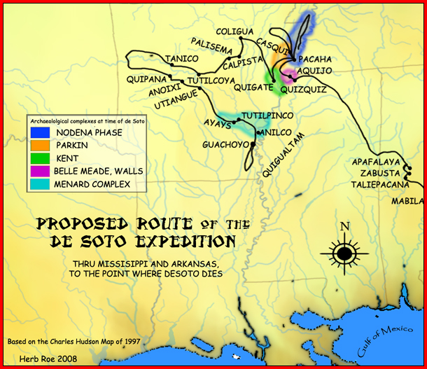
Description: A map showing the de Soto expedition route thru Mississippi, and Arkansas, up to the point de Soto dies. Based on the Charles M. Hudson map of 1997.
Title: DeSoto Map Leg 3 HRoe 2008
Credit: Own work (Original text: I created this work entirely by myself.)
Author: Heironymous Rowe (talk)
Usage Terms: Creative Commons Attribution-Share Alike 3.0
License: CC BY-SA 3.0
License Link: http://creativecommons.org/licenses/by-sa/3.0
Attribution Required?: Yes
Image usage
The following 6 pages link to this image:

All content from Kiddle encyclopedia articles (including the article images and facts) can be freely used under Attribution-ShareAlike license, unless stated otherwise.