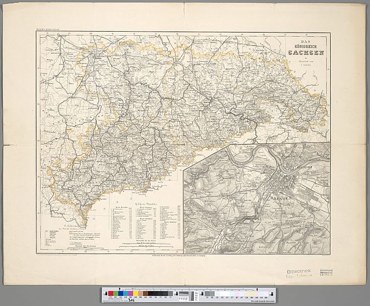
Image: Das Königreich Sachsen

Size of this preview: 724 × 599 pixels. Other resolutions: 290 × 240 pixels | 6,178 × 5,115 pixels.
Original image (6,178 × 5,115 pixels, file size: 10.5 MB, MIME type: image/jpeg)
Description: 1 Kt. : Grenzen kolor. (42 x 31 cm). Maßstab 1:530.000. Koordinaten E 11°46'00"-E 14°58'00"/N 51°30'00"-N 50°10'00". Aus: Meyer's Hand-Atlas / Joseph Meyer. Maßstab in graph. Form (Geogr. M[eile]n, Kilometer). Titel oben rechts. Legende und Maßstab unten links. - Mit 1 Nebenkt.: [Dresden]. Relief: Schraffen.
Title: Das Königreich Sachsen
Credit: Leibniz-Institut für Länderkunde e.V., Leipzig
Author: Ravenstein, Ludwig ; Radefeld, Carl Christian Franz ; Feuerstein, W. ; Meyer, Joseph (Herausgeber/-in)
Usage Terms: Creative Commons Zero, Public Domain Dedication
License: CC0
License Link: http://creativecommons.org/publicdomain/zero/1.0/deed.en
Attribution Required?: No
Image usage
The following page links to this image:

All content from Kiddle encyclopedia articles (including the article images and facts) can be freely used under Attribution-ShareAlike license, unless stated otherwise.
