
Image: Dalton II Battlefield Georgia
Size of this preview: 456 × 599 pixels. Other resolutions: 183 × 240 pixels | 1,530 × 2,010 pixels.
Original image (1,530 × 2,010 pixels, file size: 1.1 MB, MIME type: image/jpeg)
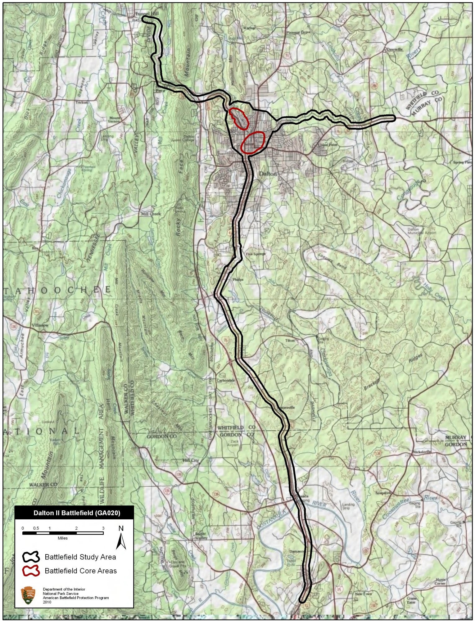
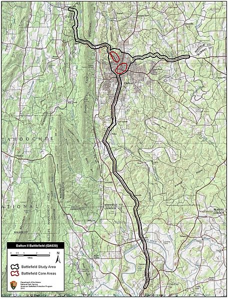
Description: Map of battlefield core and study areas. The Study Area includes roads used by the Confederate cavalry in its raids behind Union lines. The boundary also includes the Western & Atlantic Railroad line used to bring Union reinforcements to the battlefield. The Core Areas represent the specific fighting around Fort Hill and the Confederate attack on the Federal reinforcing column at the base of Mount Rachel.
Title: Dalton II Battlefield Georgia
Credit: National Park Service
Author: American Battlefield Protection Program
Usage Terms: Public domain
License: Public domain
Attribution Required?: No
Image usage
The following page links to this image:

All content from Kiddle encyclopedia articles (including the article images and facts) can be freely used under Attribution-ShareAlike license, unless stated otherwise.