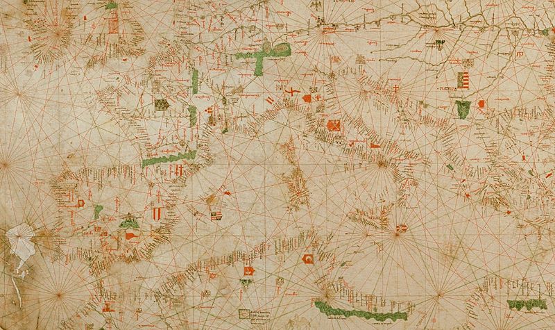
Image: Dalorto 1325 map (partial)

Size of this preview: 800 × 475 pixels. Other resolutions: 320 × 190 pixels | 1,600 × 949 pixels.
Original image (1,600 × 949 pixels, file size: 563 KB, MIME type: image/jpeg)
Description: Part of the portolan chart commonly known as the 1325 map of Angelino Dalorto (prob. same person as Angelino Dulcert, real name probably Angelino Dulceto or Dulceti, and this chart really dated 1330). It is held in the collection of Prince Corsini in Florence. This image is cropped. The full Dalorto portolan includes more of North Africa and Eastern Europe, the Black Sea, the Middle East, and parts of northern Europe and the Baltics.
Title: Dalorto 1325 map (partial)
Credit: Hicks (1929) "The Portolan Chart of Angellino de Dalorto, MCCCXX"
Author: Angelino Dalorto (or Dulcert/Dulceto/Dulceti)
Usage Terms: Public domain
License: Public domain
Attribution Required?: No
Image usage
The following page links to this image:

All content from Kiddle encyclopedia articles (including the article images and facts) can be freely used under Attribution-ShareAlike license, unless stated otherwise.
