
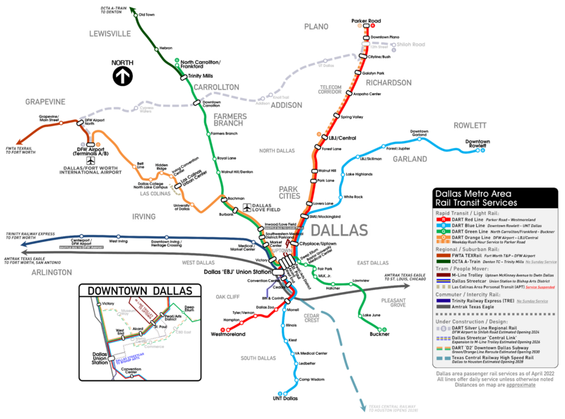
Image: Dallas Metro Area Rail Transit Services Map

Size of this preview: 800 × 594 pixels. Other resolutions: 320 × 237 pixels | 6,287 × 4,666 pixels.
Original image (6,287 × 4,666 pixels, file size: 928 KB, MIME type: image/png)
Description: Map of public rail transit serving the Dallas area within Texas, United States. Current as of April 2022.
Title: Dallas Metro Area Rail Transit Services Map
Credit: Own work
Author: Jorflores1
Usage Terms: Creative Commons Attribution-Share Alike 4.0
License: CC BY-SA 4.0
License Link: https://creativecommons.org/licenses/by-sa/4.0
Attribution Required?: Yes
Image usage
The following page links to this image:

All content from Kiddle encyclopedia articles (including the article images and facts) can be freely used under Attribution-ShareAlike license, unless stated otherwise.