
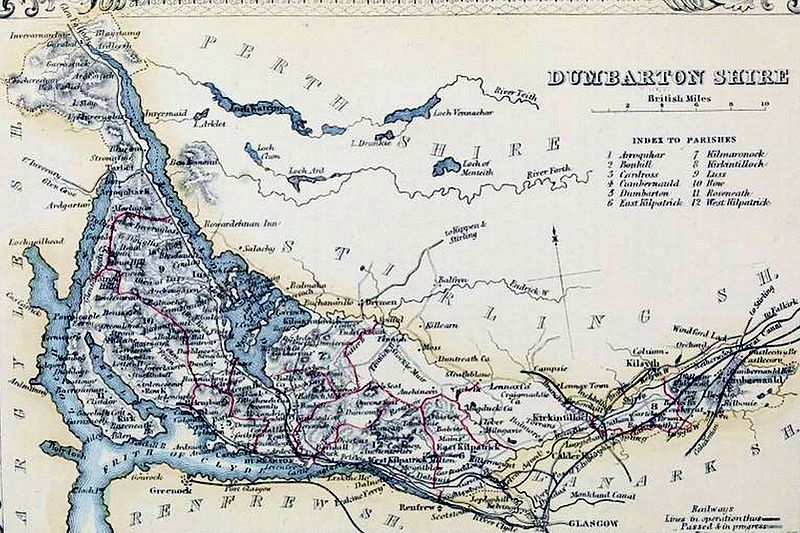
Image: DUMBARTONSHIRE Civil Parish map

Size of this preview: 800 × 533 pixels. Other resolutions: 320 × 213 pixels | 6,000 × 3,995 pixels.
Original image (6,000 × 3,995 pixels, file size: 2.06 MB, MIME type: image/jpeg)
Description: DUMBARTONSHIRE Civil Parish map. The Imperial gazetteer of Scotland. Vol.I. by Rev. John Marius Wilson. https://archive.org/stream/imperialgazettee01wils#page/n531/mode/1up
Title: DUMBARTONSHIRE Civil Parish map
Credit: https://archive.org/stream/imperialgazettee01wils#page/n531/mode/1up
Author: The Imperial gazetteer of Scotland. Vol.I. by Rev. John Marius Wilson. https://archive.org/stream/imperialgazettee01wils#page/n531/mode/1up
Usage Terms: Public domain
License: Public domain
Attribution Required?: No
Image usage
The following page links to this image:

All content from Kiddle encyclopedia articles (including the article images and facts) can be freely used under Attribution-ShareAlike license, unless stated otherwise.