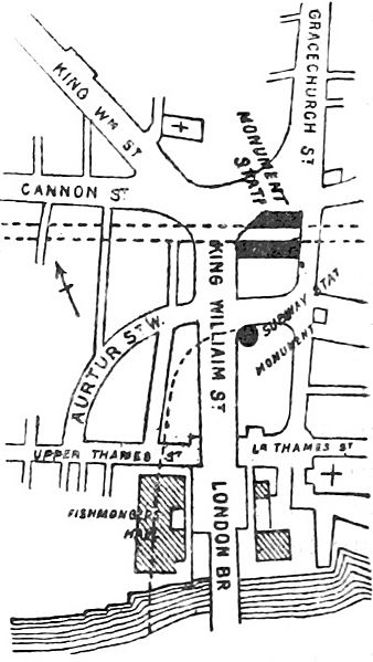
Image: DISTRICT(1888) p054 - Monument (map)

Description: 1888 plan of the area around Monument underground station in the City of London, including the proposed location of King William Street tube station. Note that the depiction of the proposed alignment of the tube line is misleading: it in fact ran directly under Arthur Street, not Fishmonger's Hall.
Title: DISTRICT(1888) p054 - Monument (map)
Credit: This file is from the Mechanical Curator collection, a set of over 1 million images scanned from out-of-copyright books and released to Flickr Commons by the British Library. View in BL Georeferencer View image on Flickr View all images from book View catalogue entry for book.
Permission: Public domainPublic domainfalsefalse This work is in the public domain in its country of origin and other countries and areas where the copyright term is the author's life plus 70 years or fewer. This work is in the public domain in the United States because it was published (or registered with the U.S. Copyright Office) before January 1, 1927. This file has been identified as being free of known restrictions under copyright law, including all related and neighboring rights. https://creativecommons.org/publicdomain/mark/1.0/PDMCreative Commons Public Domain Mark 1.0falsefalse
Usage Terms: Public domain
License: Public domain
Attribution Required?: No
Image usage
The following page links to this image:

