
Image: Cymenshore
Size of this preview: 800 × 451 pixels. Other resolutions: 320 × 180 pixels | 841 × 474 pixels.
Original image (841 × 474 pixels, file size: 33 KB, MIME type: image/jpeg)
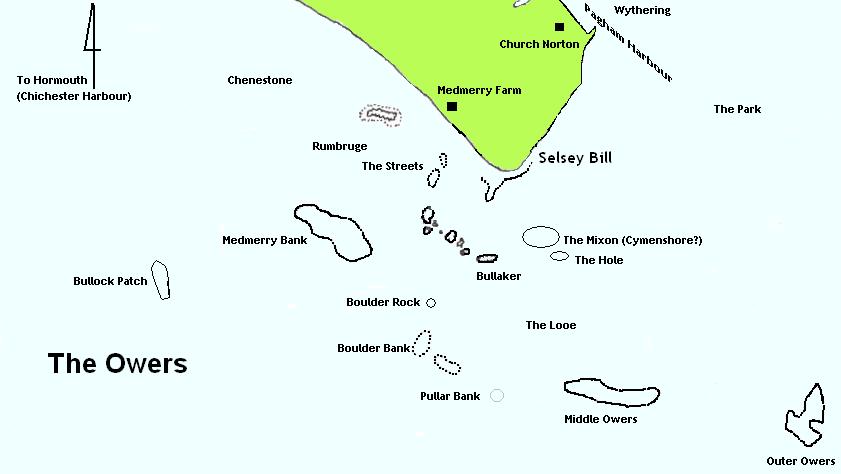
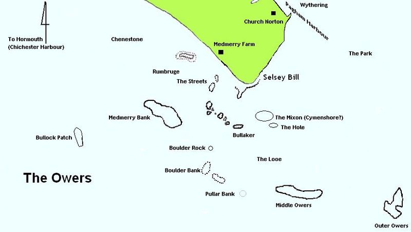
Description: Map of the Owers off Selsey Bill showing locations for Cymenshore, Rumbruge, Wytherings and Hormouth based on work by Hume-Wallace and Richardson. Location of Owers based on Admiralty Chart 2045.
Title: Cymenshore
Credit: http://www.stpeters-selsey.org.uk
Author: Michael Jones
Usage Terms: Creative Commons Attribution 3.0
License: CC-BY-3.0
License Link: https://creativecommons.org/licenses/by/3.0/
Attribution Required?: Yes
Image usage
The following page links to this image:

All content from Kiddle encyclopedia articles (including the article images and facts) can be freely used under Attribution-ShareAlike license, unless stated otherwise.