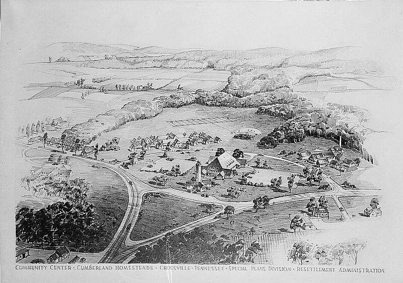
Image: Cumberland-homesteads-aerial-view-tn1

Description: "Bird's eye view" of Cumberland Homesteads in Cumberland County, Tennessee, USA, as it appeared in the late 1930s. The road veering left from the triangle corresponds to Grassy Cove Road (Hwy. 68), and the road veering right is part of modern US-127. The Homesteads Tower (still standing) is just below the center of the image. The elementary school is just above the center, and the high school is the collection of buildings on the right side of the image.
Title: Cumberland-homesteads-aerial-view-tn1
Credit: This image is available from the United States Library of Congress's Prints and Photographs division under the digital ID fsa.8e03746. This tag does not indicate the copyright status of the attached work. A normal copyright tag is still required. See Commons:Licensing for more information.
Author: Farm Security Administration
Usage Terms: Public domain
License: Public domain
Attribution Required?: No
Image usage
The following page links to this image:

