
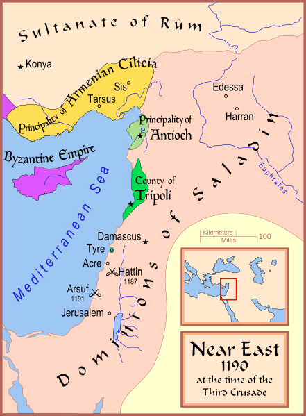
Image: Crusader States 1190

Size of this PNG preview of this SVG file: 441 × 600 pixels. Other resolution: 176 × 240 pixels.
Original image (SVG file, nominally 978 × 1,330 pixels, file size: 470 KB)
Description: A map showing the Near East (the Levant) in 1190.
Title: Map Crusader states 1190-en
Credit: Own work
Author: MapMaster
Usage Terms: Creative Commons Attribution-Share Alike 4.0
License: CC BY-SA 4.0
License Link: https://creativecommons.org/licenses/by-sa/4.0
Attribution Required?: Yes
Image usage
The following image is a duplicate of this image (more details):
The following 2 pages link to this image:

All content from Kiddle encyclopedia articles (including the article images and facts) can be freely used under Attribution-ShareAlike license, unless stated otherwise.