
Image: CroydonNSWsatellite

Size of this preview: 800 × 597 pixels. Other resolutions: 320 × 239 pixels | 893 × 666 pixels.
Original image (893 × 666 pixels, file size: 334 KB, MIME type: image/jpeg)
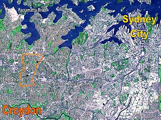
Description: Location Map for the suburb of Croydon, NSW based on NASA satellite map. Modified to identify suburb boundaries and identifiable landmarks. Original NASA image number: PIA03498
Title: CroydonNSWsatellite
Usage Terms: Public domain
License: Public domain
Attribution Required?: No
Image usage
There are no pages that link to this image.

All content from Kiddle encyclopedia articles (including the article images and facts) can be freely used under Attribution-ShareAlike license, unless stated otherwise.