
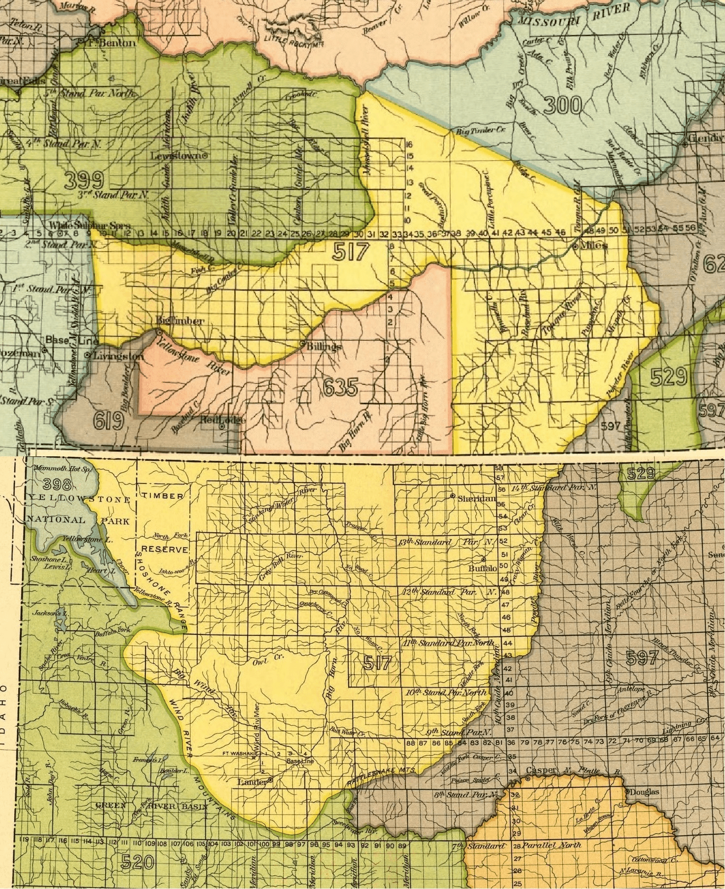
Image: Crow Indian territory (area 517, 619 and 635) as described in Fort Laramie treaty (1851), present Montana and Wyoming
Size of this preview: 489 × 599 pixels. Other resolutions: 196 × 240 pixels | 1,470 × 1,802 pixels.
Original image (1,470 × 1,802 pixels, file size: 7 MB, MIME type: image/png)
Description: Crow Indian territory (area 517, 619 and 635) as described in Fort Laramie treaty (1851), present Montana and Wyoming.
Title: Crow Indian territory (area 517, 619 and 635) as described in Fort Laramie treaty (1851), present Montana and Wyoming
Credit: 18 Annual Report of the Bureau of American Ethnology, before 1923
Author: U.S. government, maps
Usage Terms: Public domain
License: Public domain
Attribution Required?: No
Image usage
The following 4 pages link to this image:

All content from Kiddle encyclopedia articles (including the article images and facts) can be freely used under Attribution-ShareAlike license, unless stated otherwise.
_as_described_in_Fort_Laramie_treaty_(1851),_present_Montana_and_Wyoming.png)