Image: Colorado-River-Aqueduct-Map1

Size of this preview: 800 × 365 pixels. Other resolutions: 320 × 146 pixels | 2,840 × 1,296 pixels.
Original image (2,840 × 1,296 pixels, file size: 5.09 MB, MIME type: image/jpeg)
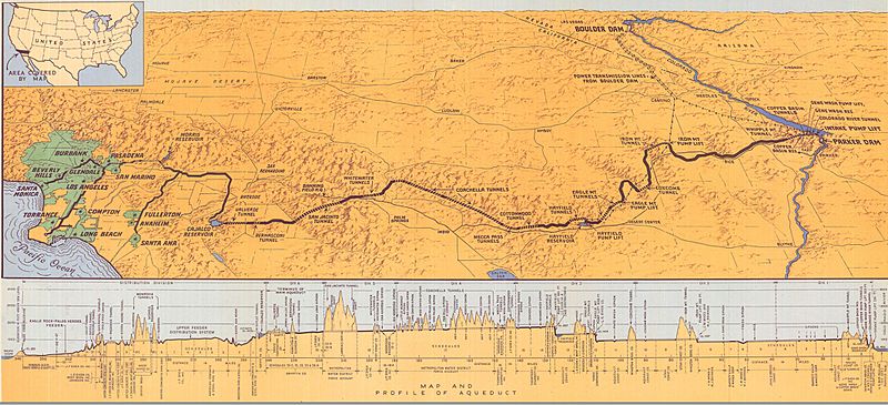
Description: Map of the Colorado River Aqueduct from The Metropolitan Water District of Southern California, History and First Annual Report for the Period Ending June 30, 1938. F. E. Weymouth, General Manager and Chief Engineer, Los Angeles 1939.
Title: Colorado-River-Aqueduct-Map1
Credit: http://www.mwdh2o.com/PDF_Who_We_Are/1.5.1_Inaugural_Annual_Report_1939.pdf The Metropolitan Water District of Southern California, History and First Annual Report for the Period Ending June 30, 1938. F.E. Weymouth, General Manager and Chief Engineer, Los Angeles 1939.
Author: unknown artist. The report that it is in is by F. E. Weymouth.
Usage Terms: Public domain
License: Public domain
Attribution Required?: No
Image usage
The following page links to this image:

All content from Kiddle encyclopedia articles (including the article images and facts) can be freely used under Attribution-ShareAlike license, unless stated otherwise.
