
Image: ColonialMissouriCa1795
Size of this preview: 800 × 422 pixels. Other resolutions: 320 × 169 pixels | 1,131 × 596 pixels.
Original image (1,131 × 596 pixels, file size: 599 KB, MIME type: image/png)
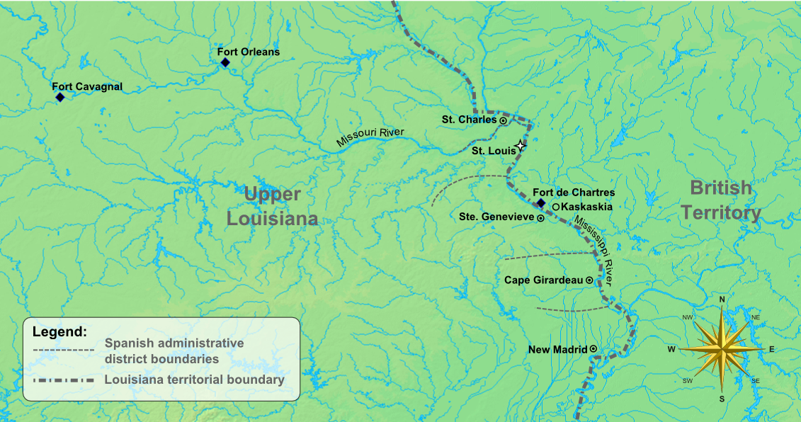
Description: Map of the early settlements and forts of Upper Louisiana (colonial-era Missouri) created using background image from DEMIS mapserver and Inkscape to add details and boundaries.
Title: ColonialMissouriCa1795
Credit: Own work
Author: Poroubalous
Usage Terms: Creative Commons Zero, Public Domain Dedication
License: CC0
License Link: http://creativecommons.org/publicdomain/zero/1.0/deed.en
Attribution Required?: No
Image usage
The following 2 pages link to this image:

All content from Kiddle encyclopedia articles (including the article images and facts) can be freely used under Attribution-ShareAlike license, unless stated otherwise.