
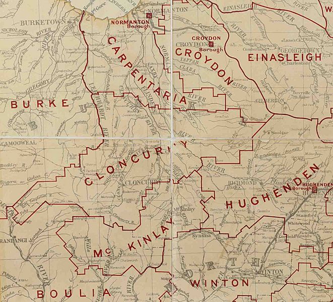
Image: Cloncurry Division, March 1902

Size of this preview: 661 × 599 pixels. Other resolutions: 265 × 240 pixels | 1,625 × 1,473 pixels.
Original image (1,625 × 1,473 pixels, file size: 461 KB, MIME type: image/jpeg)
Description: Map of Cloncurry Division and adjacent local government areas, March 1902
Title: Cloncurry Division, March 1902
Credit: Queensland, illustrating Local Authorities Districts[1], Queensland. Survey Office, 1902, available on Commons at File:Queensland-Divisions-1902.jpg
Author: Queensland Survey Office
Usage Terms: Public domain
License: Public domain
Attribution Required?: No
Image usage
The following page links to this image:

All content from Kiddle encyclopedia articles (including the article images and facts) can be freely used under Attribution-ShareAlike license, unless stated otherwise.