
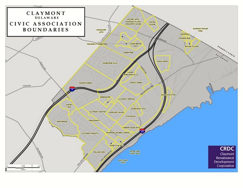
Image: Claymont Subdivisions 2018

Size of this preview: 776 × 600 pixels. Other resolutions: 311 × 240 pixels | 792 × 612 pixels.
Original image (792 × 612 pixels, file size: 106 KB, MIME type: image/jpeg)
Description: This is a WILMAPCO generated map for the Claymont Renaissance Development Corporation depicting Claymont's neighborhoods, which extend West of Interstate 95
Title: Claymont Subdivisions 2018
Credit: Own work
Author: Vincenttheuser
Usage Terms: Creative Commons Attribution-Share Alike 4.0
License: CC BY-SA 4.0
License Link: https://creativecommons.org/licenses/by-sa/4.0
Attribution Required?: Yes
Image usage
The following page links to this image:

All content from Kiddle encyclopedia articles (including the article images and facts) can be freely used under Attribution-ShareAlike license, unless stated otherwise.