
Image: Clark's Mill Battlefield Missouri
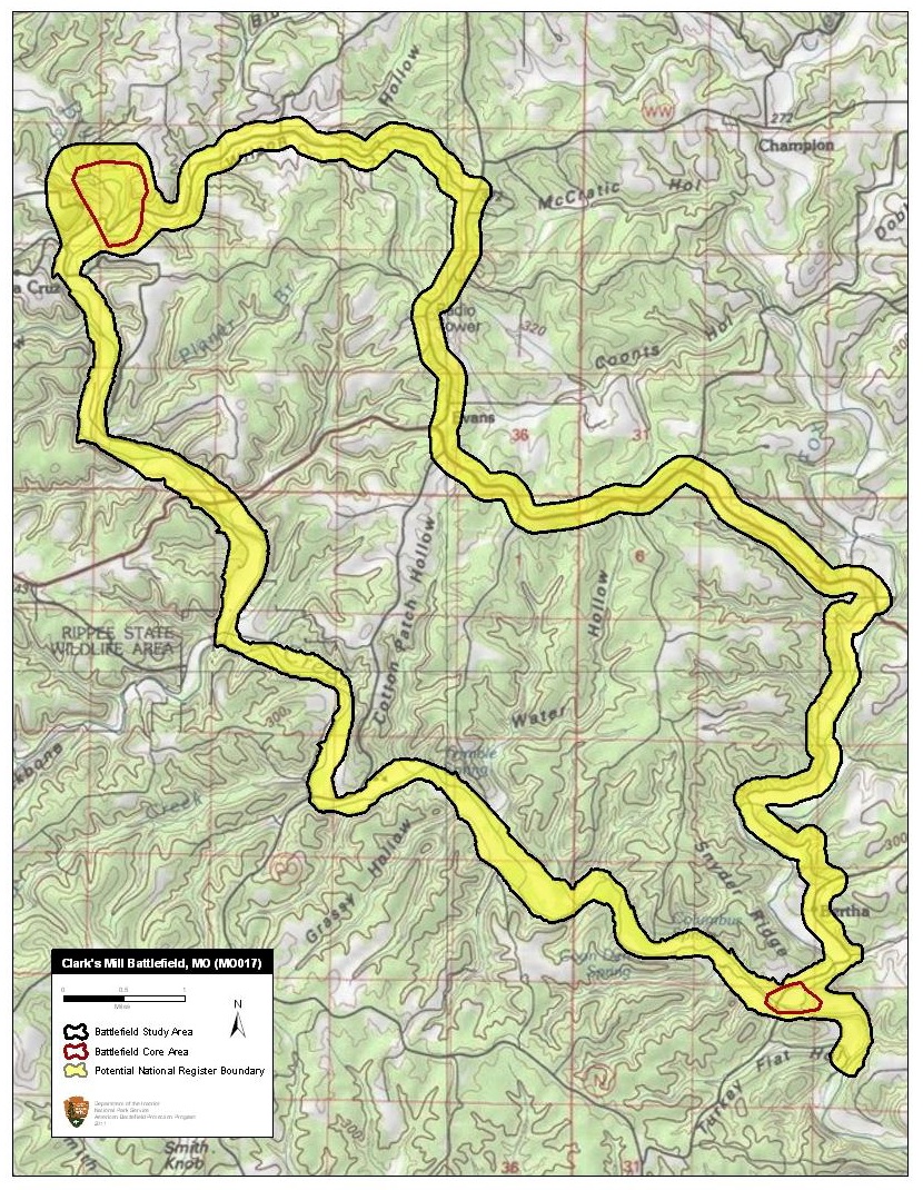
Description: Map of battlefield core and study areas. The CWSAC did not establish complete Study and Core Areas for Clark’s Mill in 1993. The newly drawn Study Area includes the Confederate advance along the creek bed of Bryant's Creek, and the Union retreat from Bryant's Creek along the Old Vera Cruz Road to Vera Cruz and the blockhouses at Clark's Mill. The lower Core Area represents the drive of the Confederate vanguard south of Vera Cruz along Bryant's Creek. The upper Core Area represents the artillery duel and skirmishing around Clark's Mill itself.
Title: Clark's Mill Battlefield Missouri
Credit: National Park Service
Author: American Battlefield Protection Program
Usage Terms: Public domain
License: Public domain
Attribution Required?: No
Image usage
The following page links to this image:
