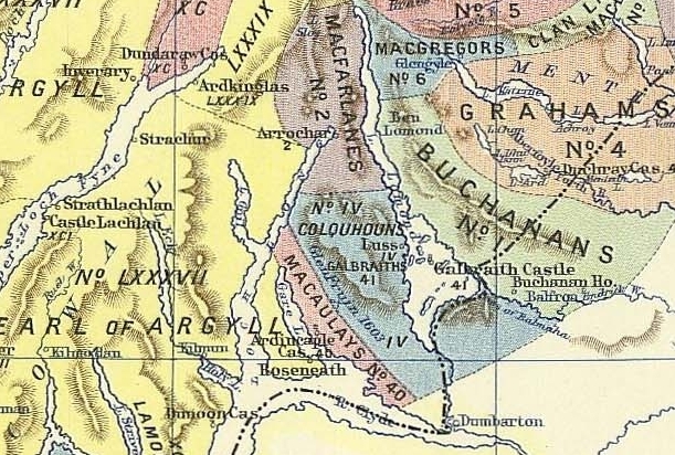
Image: Clan map, cropped, the Lennox district
Clan_map,_cropped,_the_Lennox_district.jpg (611 × 412 pixels, file size: 264 KB, MIME type: image/jpeg)
Description: Some of the Highland clans, within the Lennox district, in the late 16th century. This image is a cropped version of "Map of the clans of Scotland with the possessions of the Highland Proprietors according to the Acts of Parliament of 1587 & 1594". The map shows the locations of the clans and the land owned by the principal landowners in around 1587-1594. The map was created in the late 1800s and published in 1899.
Title: Clan map, cropped, the Lennox district
Credit: Cropped version of File:Map of the clans of Scotland (1899, third edition).jpg.
Author: Celtus (talk)
Usage Terms: Public domain
License: PD
Attribution Required?: No
Image usage
The following page links to this image:

All content from Kiddle encyclopedia articles (including the article images and facts) can be freely used under Attribution-ShareAlike license, unless stated otherwise.

