
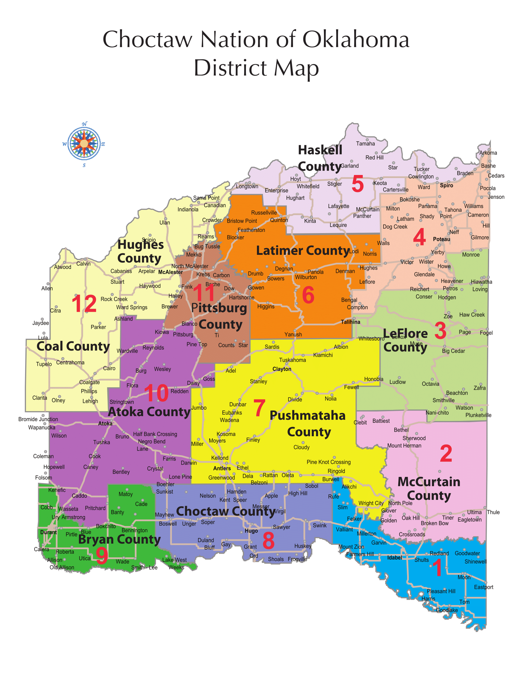
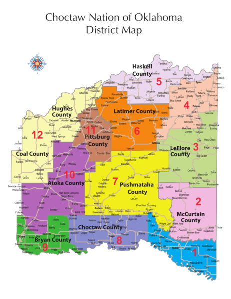
Image: Choctaw Nation District map
Size of this preview: 463 × 599 pixels. Other resolutions: 185 × 240 pixels | 1,700 × 2,200 pixels.
Original image (1,700 × 2,200 pixels, file size: 488 KB, MIME type: image/png)
Description: District map of the Choctaw Nation of Oklahoma.
Title: Choctaw Nation District map
Credit: https://www.choctawnation.com/sites/default/files/District%20Map%20copy.pdf
Author: Choctaw Nation
Usage Terms: Creative Commons Attribution-Share Alike 4.0
License: CC BY-SA 4.0
License Link: https://creativecommons.org/licenses/by-sa/4.0
Attribution Required?: Yes
Image usage
The following page links to this image:

All content from Kiddle encyclopedia articles (including the article images and facts) can be freely used under Attribution-ShareAlike license, unless stated otherwise.