
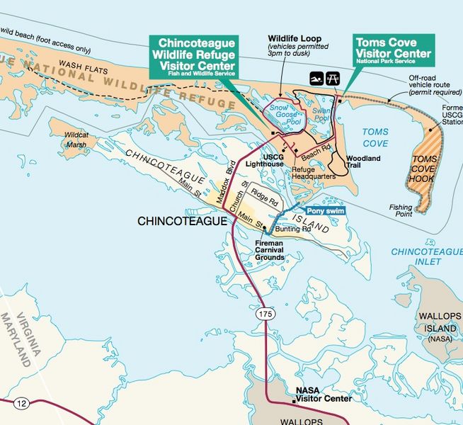
Image: Chincoteague map nps

Size of this preview: 654 × 600 pixels. Other resolutions: 262 × 240 pixels | 749 × 687 pixels.
Original image (749 × 687 pixels, file size: 183 KB, MIME type: image/jpeg)
Description: Excerpt from map of the Chincoteague-Assateague island area
Title: Chincoteague map nps
Credit: http://www.nps.gov/asis/planyourvisit/upload/parkmap.pdf US Fish and Wildlife Service brochure] for Chincoteague NWR
Author: Unknown
Permission: This image or media file contains material based on a work of a National Park Service employee, created as part of that person's official duties. As a work of the U.S. federal government, such work is in the public domain in the United States. See the NPS website and NPS copyright policy for more information.
Usage Terms: Public domain
License: Public domain
Attribution Required?: No
Image usage
The following page links to this image:

All content from Kiddle encyclopedia articles (including the article images and facts) can be freely used under Attribution-ShareAlike license, unless stated otherwise.