
Image: ChickasawWars

Size of this preview: 363 × 599 pixels. Other resolutions: 145 × 240 pixels | 490 × 809 pixels.
Original image (490 × 809 pixels, file size: 155 KB, MIME type: image/jpeg)
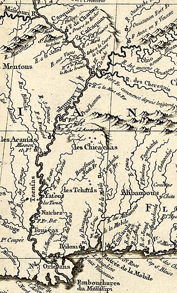
Description: Area map of the Chickasaw Wars of 1720 - 1760. French campaigns began from New Orleans and Mobile in the south, and Fort de Chartres and Fort Vincennes in the north. Fort Prudhomme was a meeting place for d'Artaguette's forces in 1736, and Fort Assumption was the meeting place for all attack forces in 1739.
Title: ChickasawWars
Credit: Source Jacques Bellin, La Lousiane et Pays Voisins, Paris, 1764. Library of Congress http://hdl.loc.gov/loc.gmd/g3300.ar011101
Author: Jacques Bellin
Usage Terms: Public domain
License: Public domain
Attribution Required?: No
Image usage
The following page links to this image:

All content from Kiddle encyclopedia articles (including the article images and facts) can be freely used under Attribution-ShareAlike license, unless stated otherwise.