
Image: Cheshunt A10 cycle link
No higher resolution available.
Cheshunt_A10_cycle_link.png (554 × 486 pixels, file size: 123 KB, MIME type: image/png)
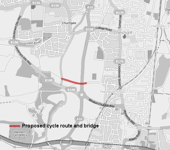
Description: A map displaying the route, in red, of the proposed Cheshunt cycle link route and new bridge over the A10. Overlaid on OpenStreetMap data.
Title: Cheshunt A10 cycle link
Credit: Own work over OpenStreetMap data.
Author: user:HelioSmith, OpenStreetMap
Usage Terms: Creative Commons Attribution-Share Alike 3.0
License: CC BY-SA 3.0
License Link: http://creativecommons.org/licenses/by-sa/3.0
Attribution Required?: Yes
Image usage
The following page links to this image:

All content from Kiddle encyclopedia articles (including the article images and facts) can be freely used under Attribution-ShareAlike license, unless stated otherwise.