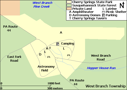
Image: Cherry Springs State Park Map
Cherry_Springs_State_Park_Map.png (536 × 378 pixels, file size: 15 KB, MIME type: image/png)
Description: Map of Cherry Springs State Park, Potter County, Pennsylvania, USA
Title: Cherry Springs State Park Map
Credit: water and roads taken from US Census website [1] and modified by User:Ruhrfisch, property boundaries and facilities based on this PennDOT map, this PA DCNR park map, this PA DCNR state forest map, and this File:Cherry Springs 1938 Aerial Photo.jpg USDA aerial photo.
Author: US Census, Ruhrfisch
Permission: US Census / US Government work is public domain, my modifications licensed under the GNU Free Documentation License
Usage Terms: Public domain
License: Public domain
Attribution Required?: No
Image usage
The following page links to this image:

All content from Kiddle encyclopedia articles (including the article images and facts) can be freely used under Attribution-ShareAlike license, unless stated otherwise.

