
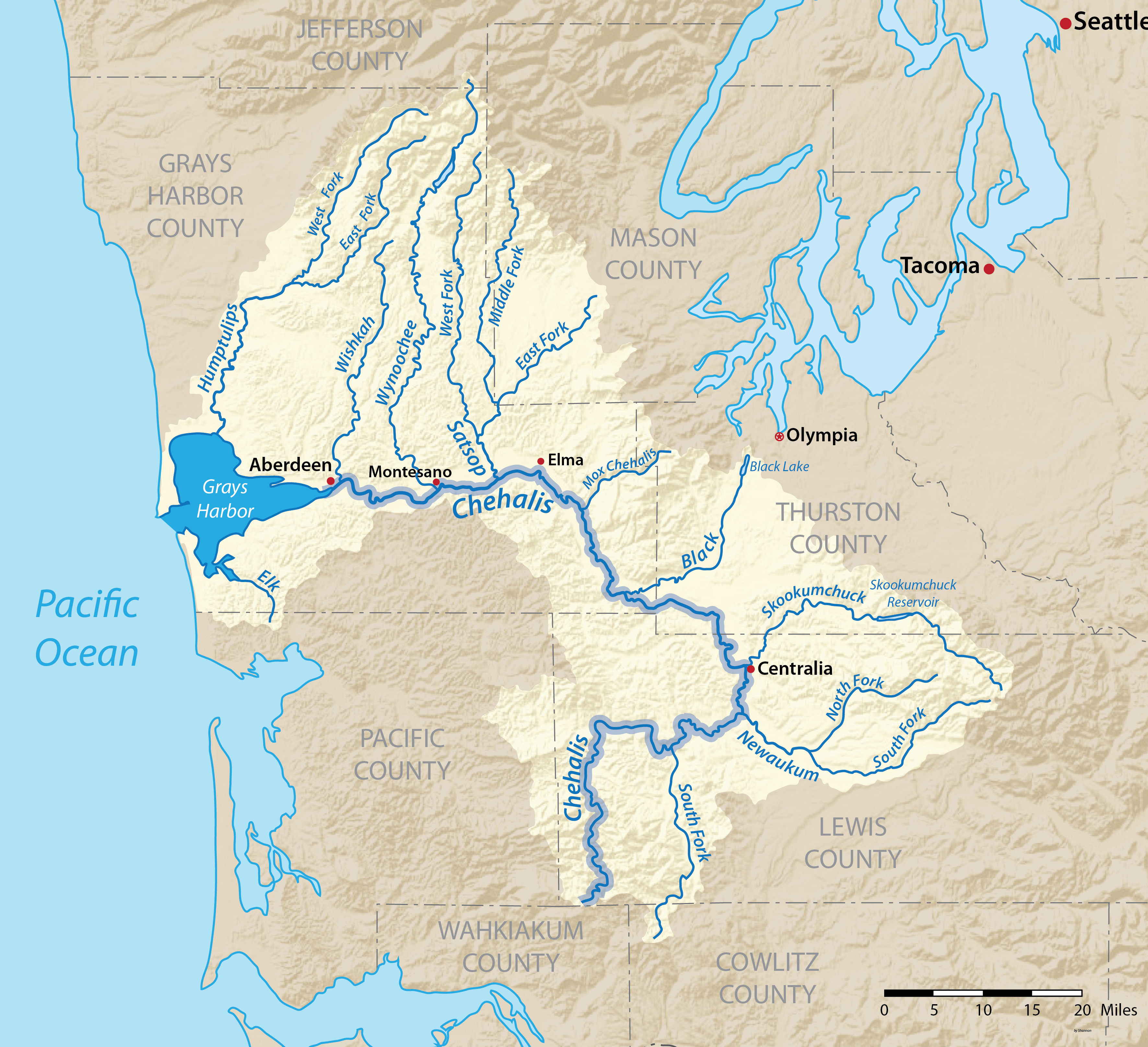
Image: Chehaliswamap-01
Size of this preview: 658 × 600 pixels. Other resolutions: 263 × 240 pixels | 3,542 × 3,229 pixels.
Original image (3,542 × 3,229 pixels, file size: 3.68 MB, MIME type: image/png)
Description: Map of the Chehalis River watershed in Washington, USA. Created based on USGS National Map data.
Title: Chehaliswamap-01
Credit: Own work
Author: Shannon1
Usage Terms: GNU Free Documentation License
License: GFDL
License Link: http://www.gnu.org/copyleft/fdl.html
Attribution Required?: Yes
Image usage
The following 2 pages link to this image:

All content from Kiddle encyclopedia articles (including the article images and facts) can be freely used under Attribution-ShareAlike license, unless stated otherwise.