Image: Chattanooga-1867-flood-tva1

Size of this preview: 532 × 600 pixels. Other resolutions: 213 × 240 pixels | 847 × 955 pixels.
Original image (847 × 955 pixels, file size: 292 KB, MIME type: image/jpeg)
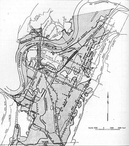
Description: Shaded map showing the extent of the March 1867 flood in downtown Chattanooga, Tennessee, USA. Dam construction by the Tennessee Valley Authority in the upper Tennessee Valley in the 1930s and 1940s largely ended Chattanooga's persistent flood problems.
Title: Chattanooga-1867-flood-tva1
Credit: Tennessee Valley Authority, The Chickamauga Project: A Comprehensive Report on the Planning, Design, Construction, and Initial Operations of the Chickamauga Project, Technical Report No. 6 (Knoxville, Tenn.: Tennessee Valley Authority, 1942), p. 36.
Author: Tennessee Valley Authority
Usage Terms: Public domain
License: Public domain
Attribution Required?: No
Image usage
The following page links to this image:

All content from Kiddle encyclopedia articles (including the article images and facts) can be freely used under Attribution-ShareAlike license, unless stated otherwise.
