
Image: Champ1632 82
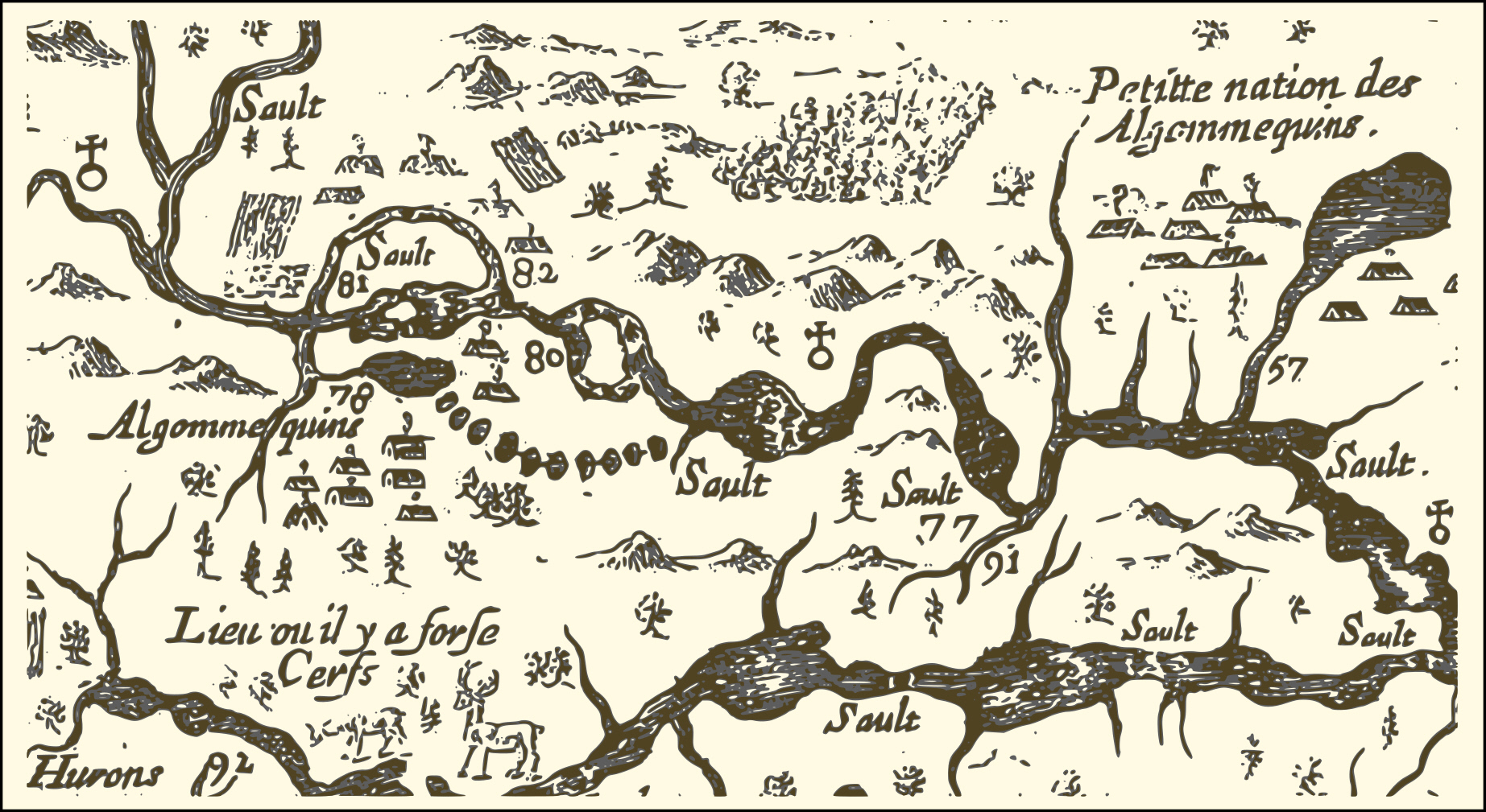
Description: An extract from a map of the eastern reaches of New France, showing a portion of the Ottawa River. The map was created in 1632 by Samuel de Champlain to show the route he took in 1616, with numbers used to indicate sites he visisted, significant rapids and aboriginal encampments. In particular, Numbers 77 and 91 correspond to the locations of the modern-day City of Ottawa and the Rideau River respectively; Number 80 marks the location of the large rapids south of Calumet Island; Number 81 shows the site of Allumette Island, inhabited at that time by members of the Algonquin nation; Number 82 corresponds roughly to the location of the modern-day village of Fort-Coulogne, and an Algonquin settlement that existed at the time of Champlain's travels; and To the north, the tree and mountain symbols presumably show the large expanses of pine forest.
Title: Champ1632 82
Credit: http://gallica.bnf.fr/ark:/12148/btv1b6700076h/
Author: Samuel de Champlain
Permission: This image from the Bibliothèque nationale de France (BnF) is a reproduction by scanning of a bidimensional work that is now in the public domain (). For this reason, it is in the public domain.
Usage Terms: Public domain
License: Public domain
Attribution Required?: No
Image usage
The following page links to this image:
