
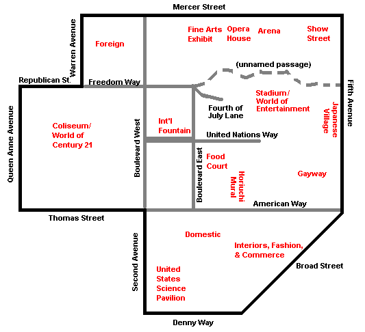
Image: Century 21 Exposition map
No higher resolution available.
Century_21_Exposition_map.png (533 × 486 pixels, file size: 8 KB, MIME type: image/png)
Description: Map of major features of Century 21 Exposition (1962; later Seattle Center). Based on maps of Seattle and on map of the exposition grounds in Official Guide Book: Seattle World's Fair 1962, Acme: Seattle (1962), p. 4–5.
Title: Century 21 Exposition map
Credit: Created by Joe Mabel using Microsoft Paint, based on cited sources
Author: Joe Mabel
Permission: Donated to public domain by author
Usage Terms: Public domain
License: Public domain
Attribution Required?: No
Image usage
The following page links to this image:

All content from Kiddle encyclopedia articles (including the article images and facts) can be freely used under Attribution-ShareAlike license, unless stated otherwise.