Image: Central valley project-01

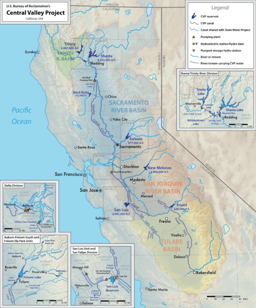
Description: Map of the federal Central Valley Project in California, USA. Intended to replace File:CVP_Map.png. Smaller details have been removed from main map and added to inset maps for easier reading. Changes: Added shared segment of California Aqueduct (San Luis Canal), Coalinga Canal, Santa Clara Conduit. Added watershed basin boundaries. Fixed alignment of Contra Costa Canal. Red Bluff diversion dam was decommissioned in 2013, replaced with pumping plant. Shaded relief from US Geological Survey.
Title: Central valley project-01
Credit: Own work
Author: Shannon1
Usage Terms: Creative Commons Attribution-Share Alike 4.0
License: CC BY-SA 4.0
License Link: https://creativecommons.org/licenses/by-sa/4.0
Attribution Required?: Yes
Image usage
The following page links to this image:

