
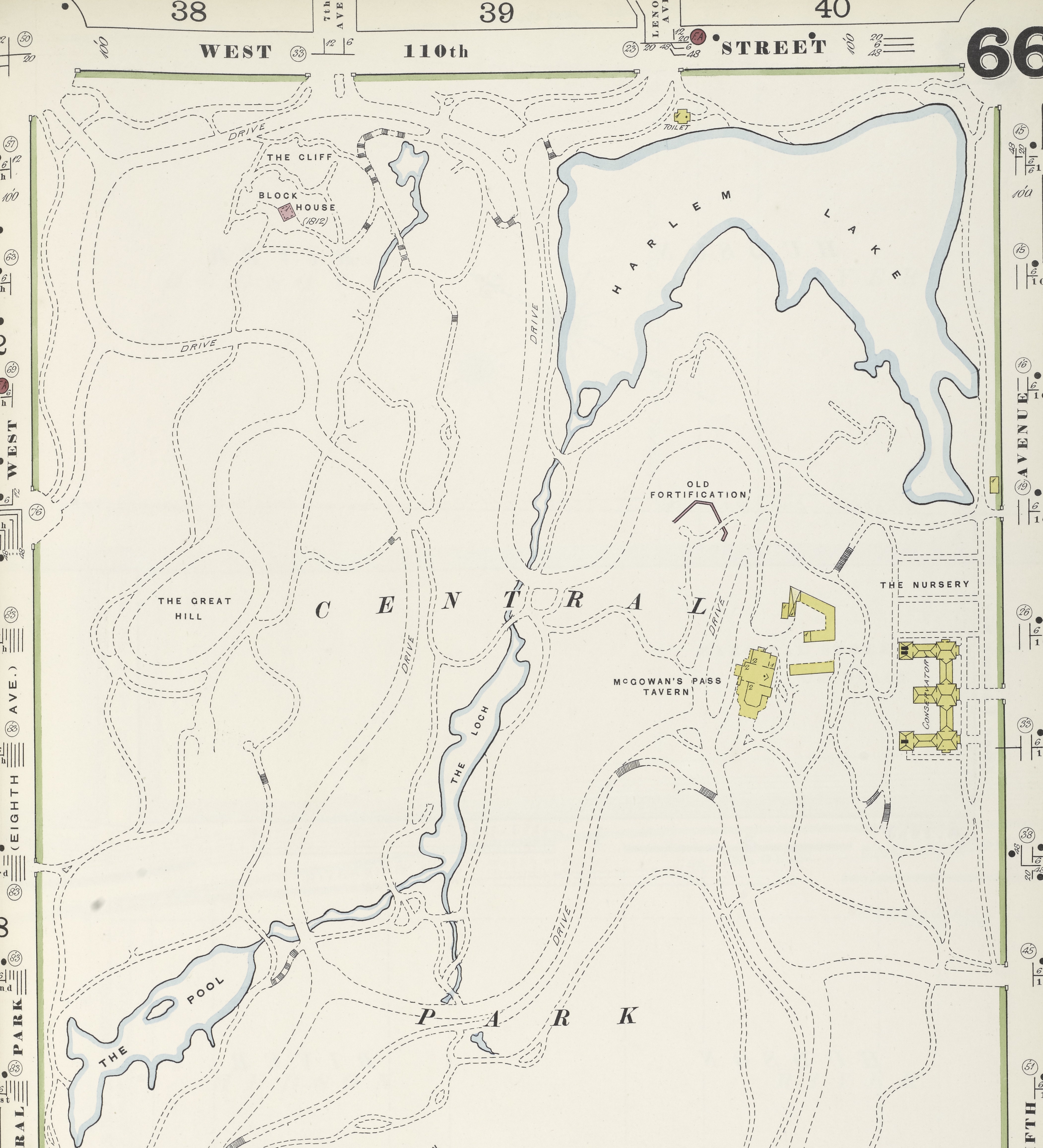
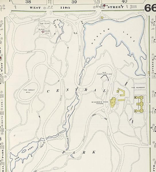
Image: Central Park 1902 Insurance Map
Size of this preview: 544 × 599 pixels. Other resolutions: 218 × 240 pixels | 4,205 × 4,630 pixels.
Original image (4,205 × 4,630 pixels, file size: 4.43 MB, MIME type: image/jpeg)
Description: A detail of Plate 66, Volume 7, Atlas 120, published in 1902 by the Sanborn Map Company, illustrating the north end of Central Park and the Harlem Meer. The image is from the New York Public Library Digital Collections.
Title: Central Park 1902 Insurance Map
Credit: Plate 66, Volume 7, Atlas 120, published in 1902 by the Sanborn Map Company; The image is from the New York Public Library Digital Collections.
Author: Sanborn Map Company
Usage Terms: Public domain
License: Public domain
Attribution Required?: No
Image usage
The following page links to this image:

All content from Kiddle encyclopedia articles (including the article images and facts) can be freely used under Attribution-ShareAlike license, unless stated otherwise.