
Image: CentervilleMines
Size of this preview: 535 × 599 pixels. Other resolutions: 214 × 240 pixels | 585 × 655 pixels.
Original image (585 × 655 pixels, file size: 79 KB, MIME type: image/png)
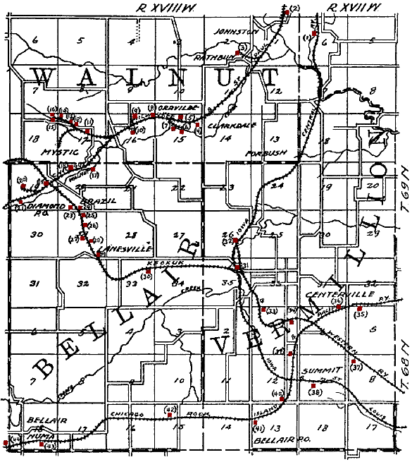
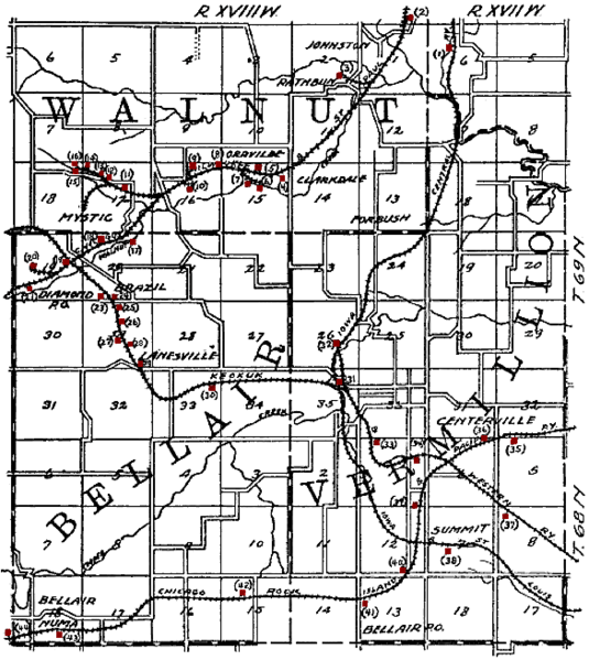
Description: Original caption: "Figure 63. Map showing shipping mines in central Appanoose county." en:Centerville, Iowa is in the lower right quadrant. Mines have been tinted red by the uploader. The railroads shown on the map are: en:Chicago, Rock Island and Pacific Railroad, en:Chicago, Milwaukee and St. Paul Railroad, en:Keokuk and Western Railroad, en:Iowa Central Railway and en:Iowa and St. Louis Railway.
Title: CentervilleMines
Credit: The Coal Deposits of Iowa, Chapter I of Iowa Geological Survey Annual Report, 1908
Author: Henry Hinds
Usage Terms: Public domain
License: Public domain
Attribution Required?: No
Image usage
The following 2 pages link to this image:

All content from Kiddle encyclopedia articles (including the article images and facts) can be freely used under Attribution-ShareAlike license, unless stated otherwise.