
Image: Castell Mawr, Pembrokeshire - geograph.org.uk - 405948
No higher resolution available.
Castell_Mawr,_Pembrokeshire_-_geograph.org.uk_-_405948.jpg (640 × 480 pixels, file size: 86 KB, MIME type: image/jpeg)
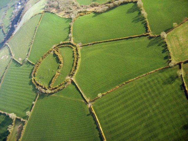
Description: Castell Mawr, Pembrokeshire An Iron Age, promontory hill fort, using the steep natural slopes as part of the defensive circuit. It is a multivallate fort, with three lines of ditch on the NE and SE sides. More information is available at http://www.dyfedarchaeology.org.uk/projects/prehistdefenc/SN56SN57ANDSN58GAZETTEER.pdf Aerial photo for paramotor.
Title: Castell Mawr, Pembrokeshire - geograph.org.uk - 405948
Credit: From geograph.org.uk
Author: Dave Price
Usage Terms: Creative Commons Attribution-Share Alike 2.0
License: CC BY-SA 2.0
License Link: https://creativecommons.org/licenses/by-sa/2.0
Attribution Required?: Yes
Image usage
The following page links to this image:

All content from Kiddle encyclopedia articles (including the article images and facts) can be freely used under Attribution-ShareAlike license, unless stated otherwise.