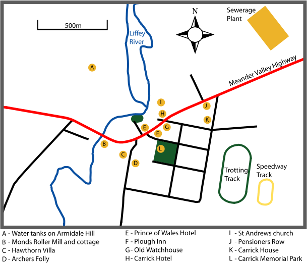
Image: Carrick tasmania outline map

Size of this PNG preview of this SVG file: 609 × 521 pixels. Other resolution: 281 × 240 pixels.
Original image (SVG file, nominally 609 × 521 pixels, file size: 118 KB)
Description: Outline map of en:Carrick, Tasmania showing many of the landmarks and registered historic properties. Map only shows the central town as much of the area known as "Carrick" is agricultural land. Self made image using (1) an aerial photo (2) council map on a sign behind the town hall (3) a bit of artistic licence in the river's upper paths as it's shallow and obscured by trees.
Title: Carrick tasmania outline map
Credit: Own work
Author: Peripitus
Usage Terms: Creative Commons Attribution-Share Alike 3.0
License: CC BY-SA 3.0
License Link: http://creativecommons.org/licenses/by-sa/3.0
Attribution Required?: Yes
Image usage
The following page links to this image:

All content from Kiddle encyclopedia articles (including the article images and facts) can be freely used under Attribution-ShareAlike license, unless stated otherwise.
