Image: CarpOffshore

Size of this preview: 776 × 600 pixels. Other resolutions: 311 × 240 pixels | 3,300 × 2,550 pixels.
Original image (3,300 × 2,550 pixels, file size: 1,019 KB, MIME type: image/jpeg)
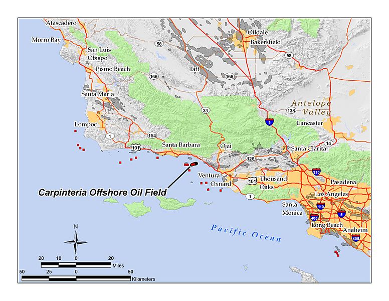
Description: Location map of the Carpinteria Offshore Oil Field — and other offshore oil fields (red squares) off coastal Santa Barbara County, California. Also showing the coastal cities and highways in the county, and adjacent Southern California counties. By self in ArcGIS 9.3; all data displayed is in the public domain
Title: CarpOffshore
Credit: Transferred from en.wikipedia to Commons by Quadell using CommonsHelper.
Author: Antandrus at English Wikipedia
Usage Terms: Creative Commons Attribution-Share Alike 3.0
License: CC BY-SA 3.0
License Link: https://creativecommons.org/licenses/by-sa/3.0
Attribution Required?: Yes
Image usage
The following page links to this image:

All content from Kiddle encyclopedia articles (including the article images and facts) can be freely used under Attribution-ShareAlike license, unless stated otherwise.
