
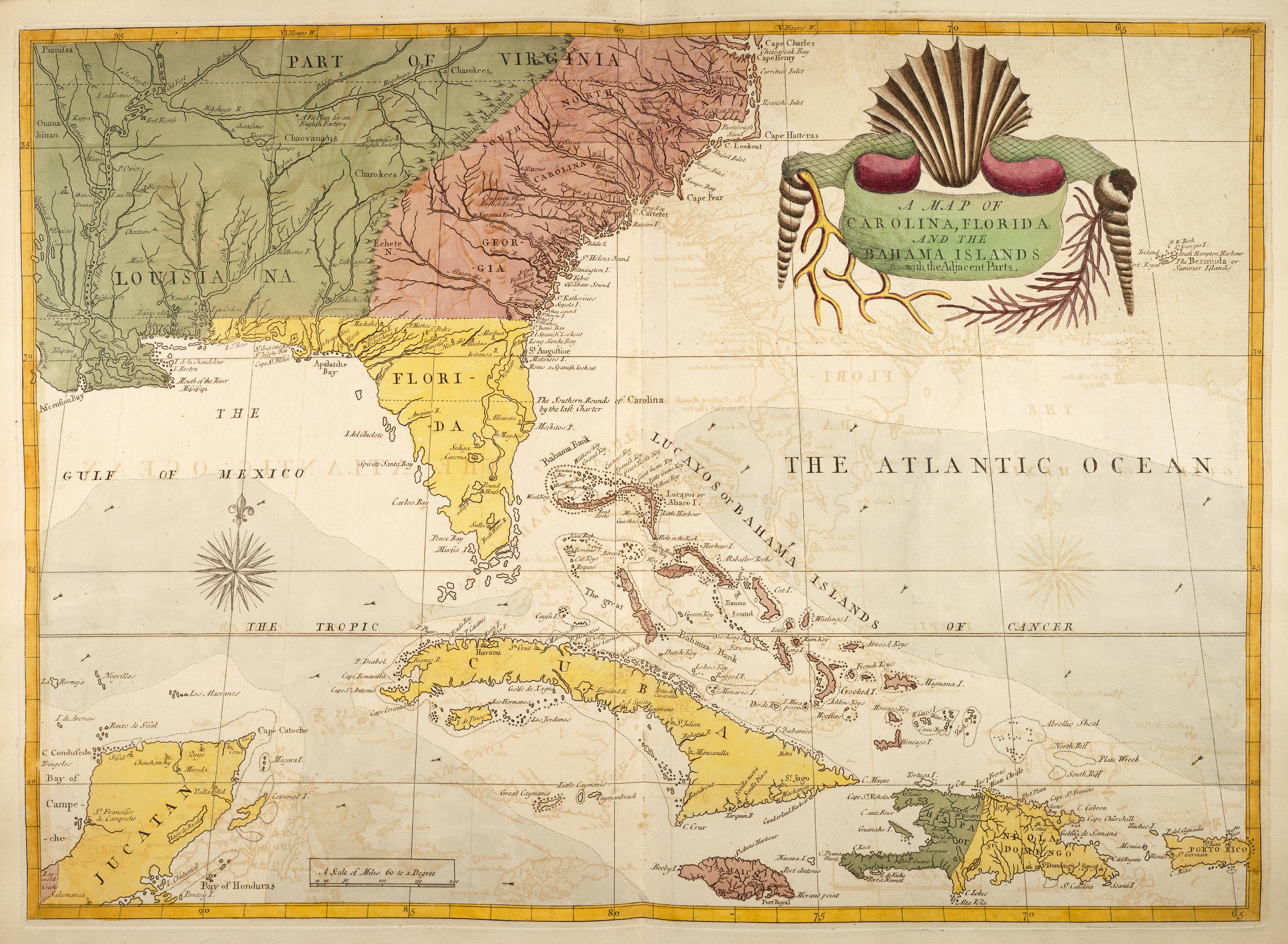
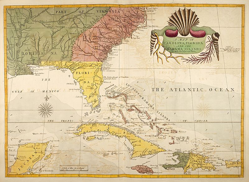
Image: Carolina-florida-bahama-map-1754
Size of this preview: 800 × 586 pixels. Other resolutions: 320 × 235 pixels | 5,919 × 4,339 pixels.
Original image (5,919 × 4,339 pixels, file size: 4.25 MB, MIME type: image/jpeg)
Description: This map appears in Volume 2 of The Natural History of Carolina, Florida and Bahamas by Mark Catesby, George Edwards published in 1754 after Plate No. 100.
Title: Carolina-florida-bahama-map-1754
Credit: The natural history of Carolina, Florida, and the Bahama Islands
Author: Catesby, Mark, Edwards, George,
Usage Terms: Public domain
License: Public domain
Attribution Required?: No
Image usage
The following page links to this image:

All content from Kiddle encyclopedia articles (including the article images and facts) can be freely used under Attribution-ShareAlike license, unless stated otherwise.