
Image: Cape to Cairo

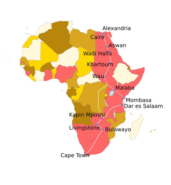
Description: Map of implemented/planned/possible routes for the Cape to Cairo railway. No differentiation between different segments (e.g. TAZARA railway, completed in 1970s only), but this would be possible. The link through Congo has never been finished, as far as I could find, but it is given in my main source - http://www.periodpaper.com/media/catalog/product/cache/1/image/8022f01105bea4edf676ba39d5976c14/T/W/TW3_327_8.JPG. Map source is File:Africa_1a.svg, with File:British Empire.png to select countries once part of the British Empire, here displayed in pink.
Title: Cape to Cairo
Credit: Own work
Author: Classical geographer
Usage Terms: Creative Commons Attribution-Share Alike 3.0
License: CC BY-SA 3.0
License Link: https://creativecommons.org/licenses/by-sa/3.0
Attribution Required?: Yes
Image usage
The following page links to this image:
