
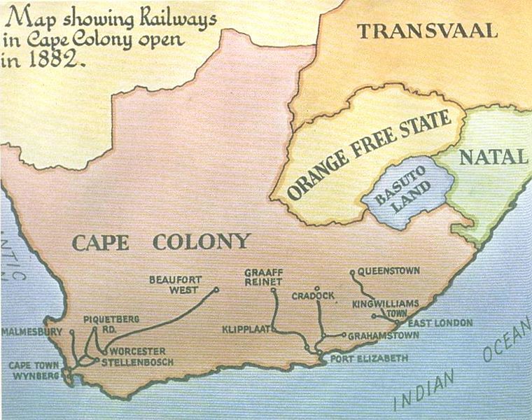
Image: Cape Government Railways map - 1882 - Cape Archives

Size of this preview: 760 × 600 pixels. Other resolutions: 304 × 240 pixels | 981 × 774 pixels.
Original image (981 × 774 pixels, file size: 116 KB, MIME type: image/jpeg)
Description: Early map of the Cape Colony's Railway system as planned by Premier Molteno and completed in 1882. From Cape Colony Archives in Cape Town
Title: Cape Government Railways map - 1882 - Cape Archives
Credit: Cape Colony Archives - Cape Town
Author: AnonymousUnknown author
Usage Terms: Public domain
License: Public domain
Attribution Required?: No
Image usage
The following page links to this image:

All content from Kiddle encyclopedia articles (including the article images and facts) can be freely used under Attribution-ShareAlike license, unless stated otherwise.