
Image: Cape Fullerton
Size of this preview: 800 × 491 pixels. Other resolutions: 320 × 196 pixels | 1,500 × 921 pixels.
Original image (1,500 × 921 pixels, file size: 372 KB, MIME type: image/png)
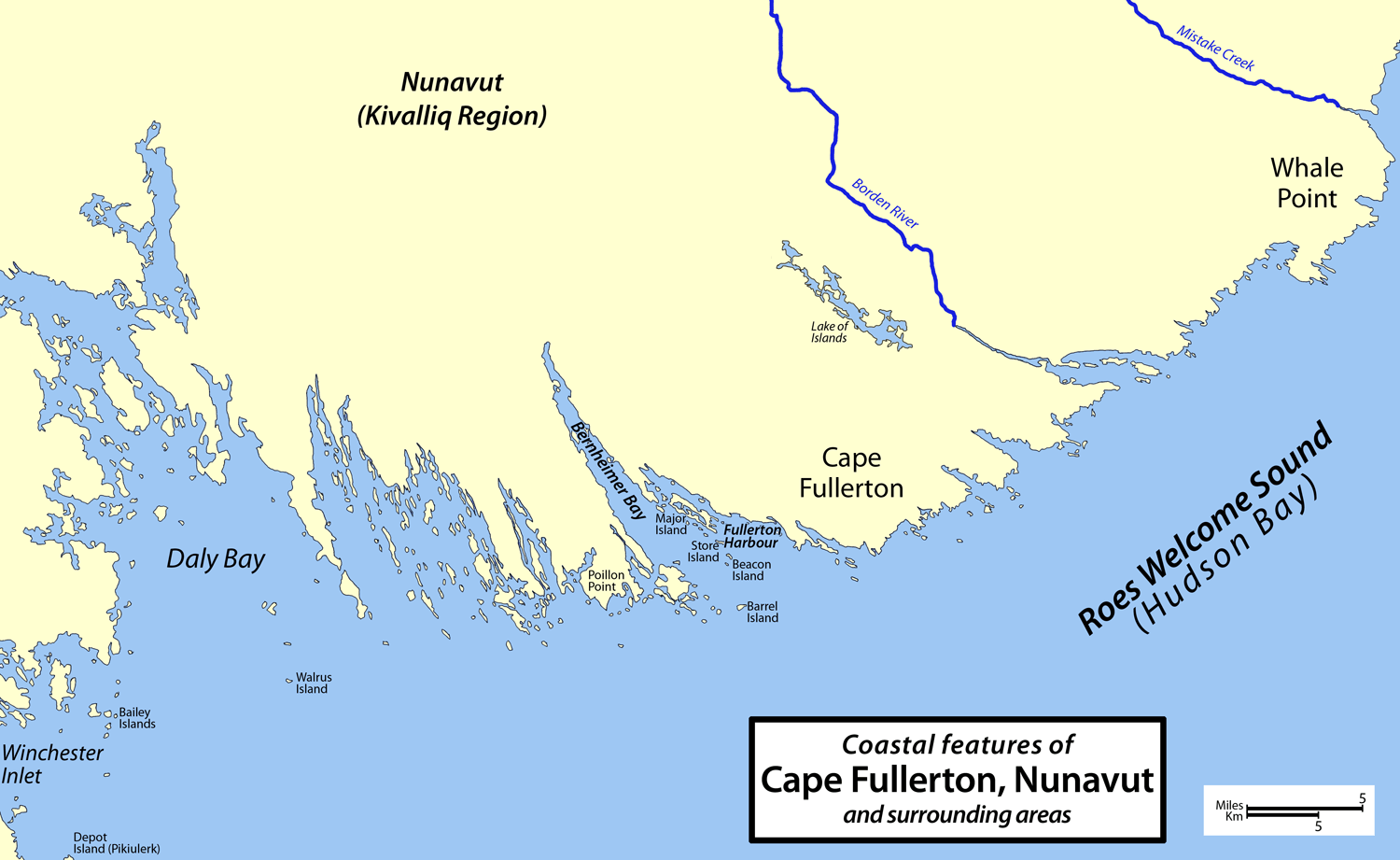
Description: Map of Cape Fullerton, Nunavut, Canada and surrounding areas, including Whale Point, Daly Bay, Bernheimer Bay, Fullerton Harbour, Winchester Inlet, Depot Island (Pikiulerk), Bailey Islands, Walrus Island, Poillon Point, Major Island, Store Island, Beacon island, Barrel Island, Lake of Islands, Borden River, and Mistake Creek.
Title: Cape Fullerton
Credit: Own work
Author: Cbaer
Usage Terms: Public domain
License: Public domain
Attribution Required?: No
Image usage
The following page links to this image:

All content from Kiddle encyclopedia articles (including the article images and facts) can be freely used under Attribution-ShareAlike license, unless stated otherwise.