
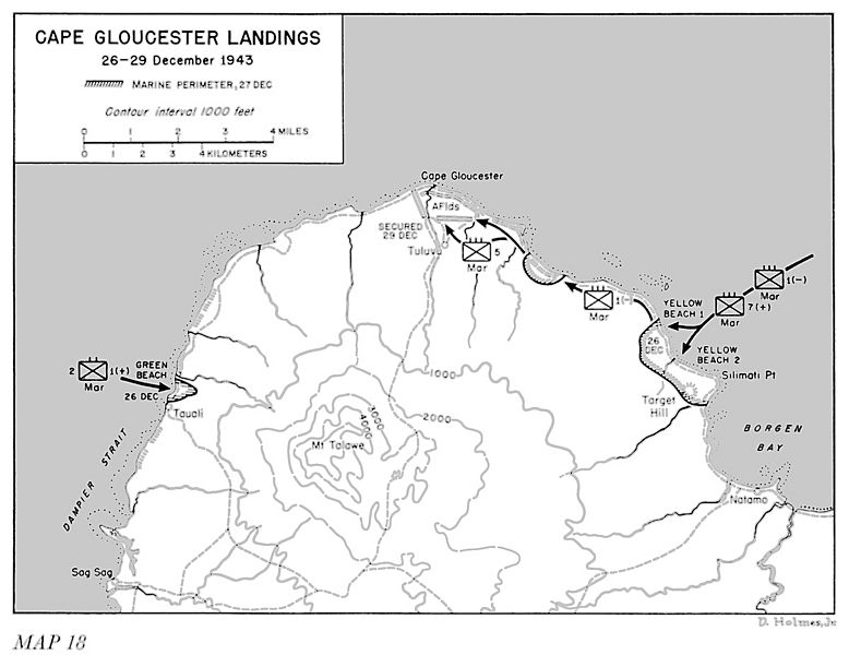
Image: CapGloucesterLandings

Size of this preview: 778 × 600 pixels. Other resolutions: 311 × 240 pixels | 1,200 × 925 pixels.
Original image (1,200 × 925 pixels, file size: 179 KB, MIME type: image/jpeg)
Description: Map showing US military landing operations around Cape Gloucester
Title: CapGloucesterLandings
Credit: Miller, John, Jr. (1959) Cartwheel: The Reduction of Rabaul, Office of the Chief of Military History, U.S. Department of the Army, p. 292 OCLC: 63151382.
Author: Department of the Army
Usage Terms: Public domain
License: Public domain
Attribution Required?: No
Image usage
The following page links to this image:

All content from Kiddle encyclopedia articles (including the article images and facts) can be freely used under Attribution-ShareAlike license, unless stated otherwise.