
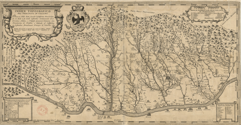
Image: Cantacuzino Wallachia

Size of this preview: 800 × 415 pixels. Other resolutions: 320 × 166 pixels | 4,014 × 2,080 pixels.
Original image (4,014 × 2,080 pixels, file size: 15.42 MB, MIME type: image/png)
Description: 17th century map of Wallachia (nowadays, Southern Romania), by stolnic Constantin Cantacuzino
Title: Cantacuzino Wallachia
Credit: Bibliothèque nationale de France, département Cartes et plans, CPL GE DD-2987 (5946 B)
Author: stolnic Constantin Cantacuzino (d. 1716)
Usage Terms: Public domain
License: Public domain
Attribution Required?: No
Image usage
The following page links to this image:

All content from Kiddle encyclopedia articles (including the article images and facts) can be freely used under Attribution-ShareAlike license, unless stated otherwise.