
Image: Canada change 1874-06-26
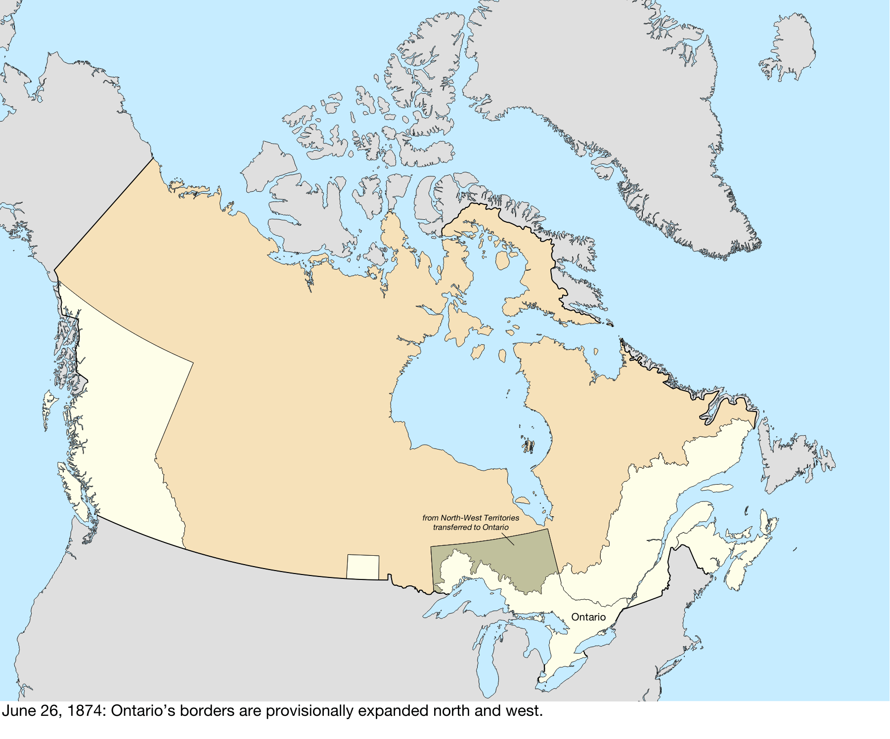
Description: Map of the change to Canada on June 26, 1874. The borders of Ontario were provisionally expanded north and west. When the Province of Canada was formed, its borders were not entirely clear, and Ontario claimed to eventually reach all the way to the Rocky Mountains and Arctic Ocean. With Canada's acquisition of Rupert's Land, Ontario was interested in clearly defining its borders, especially since some of the new areas it was interested in were rapidly growing. After the federal government asked Ontario to pay for construction in the new disputed area, the province asked for an elaboration on its limits, and its boundary was moved north to 51° north, and west to a line running north from Hunter's Island.[1] This was built with the shapefiles: Territorial Evolution, from the University of Toronto: https://doi.org/10.5683/SP2/IQ7E0X Global Islands: https://doi.org/10.5066/P91ZCSGM United States maritime borders: https://nauticalcharts.noaa.gov/data/us-maritime-limits-and-boundaries.html United States details from the Newberry Library: https://digital.newberry.org/ahcb/ Canada detailed administrative divisions: https://www12.statcan.gc.ca/census-recensement/2021/geo/sip-pis/boundary-limites/index2021-eng.cfm?year=21 ↑ Mills, David (1877) [[[:Template:Google books]] Report on the Boundaries of the Province of Ontario], Toronto: Hunter, Rose & Co, p. 347
Title: Canada change 1874-06-26
Credit: Own work
Author: Golbez
Usage Terms: Creative Commons Attribution-Share Alike 4.0
License: CC BY-SA 4.0
License Link: https://creativecommons.org/licenses/by-sa/4.0
Attribution Required?: Yes
Image usage
The following page links to this image:
