
Image: CamdenAmboy Map 1869
Size of this preview: 433 × 599 pixels. Other resolutions: 173 × 240 pixels | 656 × 907 pixels.
Original image (656 × 907 pixels, file size: 253 KB, MIME type: image/jpeg)
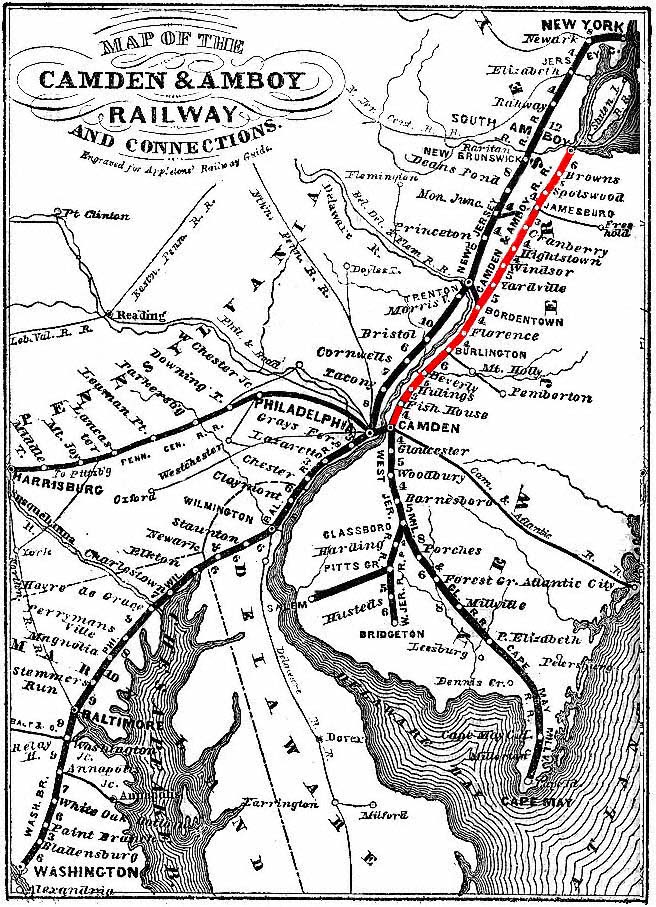
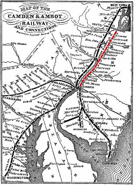
Description: Map of the Camden & Amboy Railway and connections, as engraved for Appletons' Railway and Steam Navigation Guide (1869), showing the old alignment that operated north from Trenton until May 29, 1865. The C&A main line has been digitally colored red in this illustration.
Title: CamdenAmboy Map 1869
Credit: Scanned route colorized by uploader.
Author: This media Centpacrr (talk) (Uploads) Original Map
Usage Terms: Public domain
License: Public domain
Attribution Required?: No
Image usage
The following 2 pages link to this image:

All content from Kiddle encyclopedia articles (including the article images and facts) can be freely used under Attribution-ShareAlike license, unless stated otherwise.