
Image: CAN SK Swift Current map 2021

Size of this preview: 600 × 600 pixels. Other resolutions: 240 × 240 pixels | 1,300 × 1,300 pixels.
Original image (1,300 × 1,300 pixels, file size: 456 KB, MIME type: image/png)
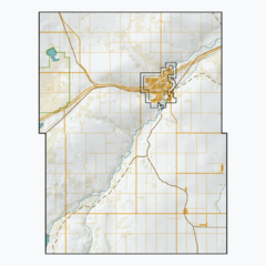
Description: A series of maps of Saskatchewan rural municipalities, using open CEC Landsat-derived land cover data (2015) to generate a naturalistic colour scheme. Generalized hillshade created with my own proprietary algorithm. Vector features from Saskatchewan's ISC, the Government of Canada, and some manual digitization of urban footprints and abandoned railways. Made with QGIS.
Title: CAN SK Swift Current map 2021
Credit: Own work
Author: awmcphee
Usage Terms: Creative Commons Zero, Public Domain Dedication
License: CC0
License Link: http://creativecommons.org/publicdomain/zero/1.0/deed.en
Attribution Required?: No
Image usage
There are no pages that link to this image.

All content from Kiddle encyclopedia articles (including the article images and facts) can be freely used under Attribution-ShareAlike license, unless stated otherwise.