
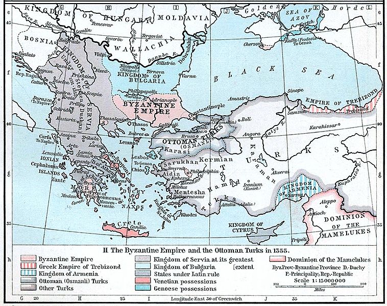
Image: Byzantine empire 1355

Size of this preview: 758 × 600 pixels. Other resolutions: 304 × 240 pixels | 1,134 × 897 pixels.
Original image (1,134 × 897 pixels, file size: 380 KB, MIME type: image/jpeg)
Description: Map of the Byzantine, Ottoman and Serbian empires and their neighboring states, 1355.
Title: Byzantine empire 1355
Credit: William R. Shepherd's Historical Atlas, p. 89, published by Henry Holt and Company, New York 1911
Author: William Robert Shepherd
Usage Terms: Public domain
License: Public domain
Attribution Required?: No
Image usage
The following 2 pages link to this image:

All content from Kiddle encyclopedia articles (including the article images and facts) can be freely used under Attribution-ShareAlike license, unless stated otherwise.