
Image: Byzantine Empire 1270 historical

Size of this preview: 800 × 371 pixels. Other resolutions: 320 × 148 pixels | 802 × 372 pixels.
Original image (802 × 372 pixels, file size: 65 KB, MIME type: image/png)
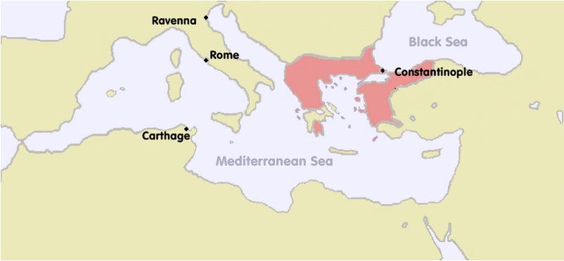
Description: This map was created using detailed checking of the dates when various Anatolian towns fell to Turkish rule. Based on this information, the frontiers of the Byzantine Empire have been amended to be more historically accurate and precise.
Other information
This file is based on File:Byzantium1270.png, which was itself based on an original made by me many years ago.
Author: Bigdaddy1204
Usage Terms: Creative Commons Attribution-Share Alike 3.0
License: CC-BY-SA-3.0
License Link: http://creativecommons.org/licenses/by-sa/3.0/
Attribution Required?: Yes
Image usage
The following page links to this image:

All content from Kiddle encyclopedia articles (including the article images and facts) can be freely used under Attribution-ShareAlike license, unless stated otherwise.