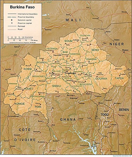
Image: Burkina Faso Map

Size of this preview: 505 × 599 pixels. Other resolutions: 202 × 240 pixels | 979 × 1,162 pixels.
Original image (979 × 1,162 pixels, file size: 259 KB, MIME type: image/jpeg)
Description: Shaded relief map of Burkina Faso.
Title: Burkina Faso Map
Credit: [1] from the Perry-Castañeda Library Map Collection.
Author: CIA
Permission: This image is a work of a Central Intelligence Agency employee, taken or made as part of that person's official duties. As a Work of the United States Government, this image or media is in the public domain in the United States. Български | Čeština | Deutsch | English | Español | Eesti | Suomi | Italiano | 日本語 | 한국어 | Македонски | മലയാളം | Polski | Português | Русский | Sicilianu | Slovenščina | Українська | 中文 | 中文(简体) | +/−
Usage Terms: Public domain
License: Public domain
Attribution Required?: No
Image usage
The following page links to this image:

All content from Kiddle encyclopedia articles (including the article images and facts) can be freely used under Attribution-ShareAlike license, unless stated otherwise.
