
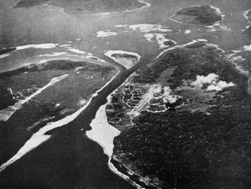
Image: Buka Passage NAN1Jan44
Size of this preview: 796 × 599 pixels. Other resolutions: 319 × 240 pixels | 838 × 631 pixels.
Original image (838 × 631 pixels, file size: 204 KB, MIME type: image/jpeg)
Description: An aerial photograph of the Buka Passage between Bougainville (left) and Buka (right) islands in the Solomon Islands in 1943. Two Japanese airfields are visible, Buka airfield (center) and Bonis airfield (left). Today Buka airfield is Bougainville's major airport whereas Bonis is disused since the Second World War.
Title: Buka Passage NAN1Jan44
Credit: U.S. Navy Naval Aviation News 1 January 1944 [1]
Author: USN
Usage Terms: Public domain
License: Public domain
Attribution Required?: No
Image usage
The following page links to this image:

All content from Kiddle encyclopedia articles (including the article images and facts) can be freely used under Attribution-ShareAlike license, unless stated otherwise.