
Image: Buildings destroyed by 2021 Cumbre Vieja eruption
Size of this preview: 800 × 510 pixels. Other resolutions: 320 × 204 pixels | 1,315 × 838 pixels.
Original image (1,315 × 838 pixels, file size: 788 KB, MIME type: image/png)
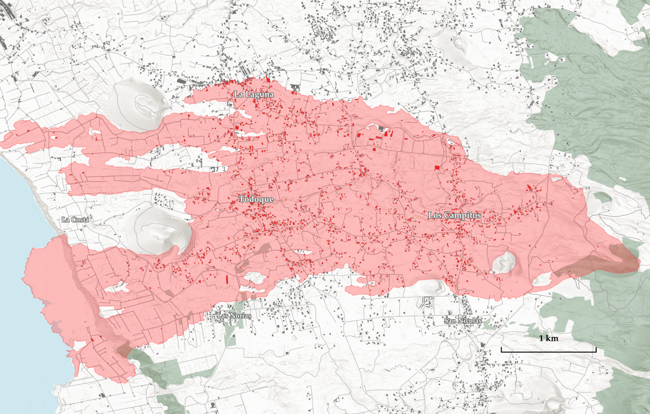
Description: Map showing the extent of lava from the 2021 Cumbre Vieja volcanic eruption and buildings destroyed by lava, as of 2021/11/23. Sources: Land coverage, buildings, roads - OpenStreetMap data Lava extent - Copernicus Project Hillshade - processing of data from the SRTM mission Location of destroyed buildings - intersection of buildings layer with lava extent layer
Title: Buildings destroyed by 2021 Cumbre Vieja eruption
Credit: Own work
Author: Jakub Kaczorowski
Usage Terms: Creative Commons Attribution-Share Alike 4.0
License: CC BY-SA 4.0
License Link: https://creativecommons.org/licenses/by-sa/4.0
Attribution Required?: Yes
Image usage
The following 3 pages link to this image:

All content from Kiddle encyclopedia articles (including the article images and facts) can be freely used under Attribution-ShareAlike license, unless stated otherwise.